The more time I spent canoeing in Killarney the idea of hiking the 80km (ish) LaCloche trail seemed continuously more appealing. It is a pristine example of Ontario’s wilderness. WIth the stunning and immense Georgian Bay as a backdrop to the stark white quartzite mountains (the remains of an ancient mountain range that once stood taller than the Himalayas) and surreal aquamarine lakes dappeling the landscape, seeing this piece of land from another vantage point was a no brainer.
I booked my trip in a haste, roughly 4 months in advance of my intended start date. I had chosen campsites along the route based on distance between each one and other people’s trip reports that I had skimmed over. As with any trip to Killarney roughly 75% of all the sites I had initially chosen were already booked. Last minute changes to my plan were made on the phone while booking (you can tell where things got desperate by looking at my map!). If you want to have the best possible experience in this park and get first pick of sites BOOK FAR IN ADVANCE! My decision to hike the trail counter clockwise definitely helped in finding sites that did not affect my initial plan too drastically. I liked the idea of having a heavier pack and less tired/blistered feet for thre more technical parts of the trail as I tend to be a little wobbly on the descent (long legs and shotty knees).
My wilderness adventures always feel incomplete without my dogs alongside....so I obviously intended to bring them along for the trip. I had seen some of the more difficult sections of the trail before and both dogs had no issues with the terrain so I was confident they would be able to hack it. I will say that ONLY fit and nimble pooches should be brought along on this trip. There were several sections that required me to lift them up very steep rock ledges and required removal of their packs (which meant more baggage for me!) in order to ensure their safety. I will touch on several other doggy issues throughout the rest of this trip report...

Obligitory photo in front of the trail head....dogs didn’t feel like posing.

The route!
DAY 1- OCTOBER 2 GEORGE LAKE-PROULX LAKE
14.1km-88 Floors Climbed
The day started at site 92 at George Lake. I had initially planned to leave around 7am but didn’t end up getting on the trail until 8:30 or so. First lesson of this trip....packing up camp takes MUCH longer solo!
First leg of the trail was beautiful first thing in the morning with the fog rolling off George Lake. We winded through thick forests, over a beaver damn and over s small bridge before ascending “the Crack”.
The dogs and I had hiked this section earlier in the year. It was immensely more challenging with a full pack! The dogs did great and were very popular with the many tourists sharing the trail with us. I had to help Wendy and carry her pack up the tricker parts of the steep rocky chasm. Her bag made her too wide to safely navigate the boulders, with me carrying extra baggage it mad for a slow climb.

View from the top of the crack.
We stoped for a quick lunch break at the top and I made sure the dogs had a good drink of water. The rest of the day would wind along Killarney ridge, a greater difficulty hike than I was imagining....many steep drops which are my weakest point, I had to take my bag off a few times and lower it down ahead of me in order to keep my balance. We ran into a few groups of hikers along the way. Walking the trail counter clockwise means running into more people but never feeling like you’re stuck behind anyone. It makes for pleasant but brief interactions. The last gentleman I ran into said he had spotted a bear near David lake which increased my anxiety of hiking alone ever so slightly. My concern for bears has always been minimal. I take the obvious precautions and having two noisey dogs alongside definitely seems like a good buffer. To minimize the risk of startling the wildlife I have bells on each of their packs and I keep Rufio (who is way more likely to chase a strange animal) on leash through the heavily wooded areas where my line of sight is compromised and distractions are at their peak. I also keep them leashed while around other hikers who may be nervous around strange dogs. After nearly 9 hours of hiking we made camp at Proulx lake. It was a steep climb into the site which seemed extra strenuos after a long day but this first campsite along the trail was incredible! The lake itself was stunning and the site had a tent pad which is something I have come across very often.

Wendy assessing the terrain.

Views along Killarney ridge.
Wendy making things look easy.....

Almost at camp.

Proulx Lake campsite. Tent pad is dog aprooved.

campsite H48....Proulx Lake

First night’s sunset.
DAY 2: OCOTOBER 3, PROULX LAKE-SILVER LAKE 13.7KM 103 Floors climbed
Today we climbed....up, then down, then up then down again....all day. Heading out from Proulx lake the trail winded through the forest. I kept Rufio on a leash as the news of a bear sighting had me on high alert. He pulls a lot as his pack acts sort of like a harness (this actually helps me out a little on flat ground and mild inclines) I brought the lines we use while dog sledding in the winter. They’re lightweight, have elasticity to prevent excessive strain, and it has two clips on the end so keeping both dogs on lead is easy if need be. Works out to be about 15 feet long which is enough to not be tripping over them on the trail as well.
The views all day were stunning and well worth the effort. It was during this section of the hike where I developed terrible blisters on both my heels. I was very thankful for my last minute blister first aid treatment purchase! It’s incredible how such a small thing can have an immense effect on your overal comfort and enjoyment of the hike. BRING BLISTER CARE!

Proulx lake in the distance after our first long ascent.

Dogs are better at hiking...they’re always watching me struggle up the tough climbs.

The trail had views like this all day.....not bad.
The trail finally descended back into the forest after a long day hiking up and down the rocky ridges. Wooded areas are much easier on the feet! Silver Lake was a welcome sight to behold with several small canyons of rocks lined with ferns flanking the trail to the campsite.
Site H37 was quite picturesque but the water access was STEEP. There is a note about this on the map. It was impossible for me to retrieve non swampy water safely so I ended up walking to campsite H38 to acquire some.

Silver Lake campsite #37

Day 3: SILVER LAKE-DAVID LAKE 7.8km, 29 floors climbed
After a wet start to the hike the trail leveled out substantially from the previous 2 days. A few kilometres of soft forest ground was a welcome rest for my very blistered ankles.
The side trail to Silver peak came quickly. After a few minutes of contemplation (which seemed like en eternity) I decided that an early arrival to my next campsite and an opportunity to clean and dry out my worsening blister situation was worth more than adding the summit of Silver peak to my trip report....I’ll just have get it another time.
Moving onward feeling somewhat defeated we climbed to the top of some quartzite ridges that had a spectacular view of David Lake to the North and Silver peak to the South. Stunning! Viewing silver peak while feeling my feet protest more than they had the whole trip was enough validation for my skipping the side trail earlier in the day
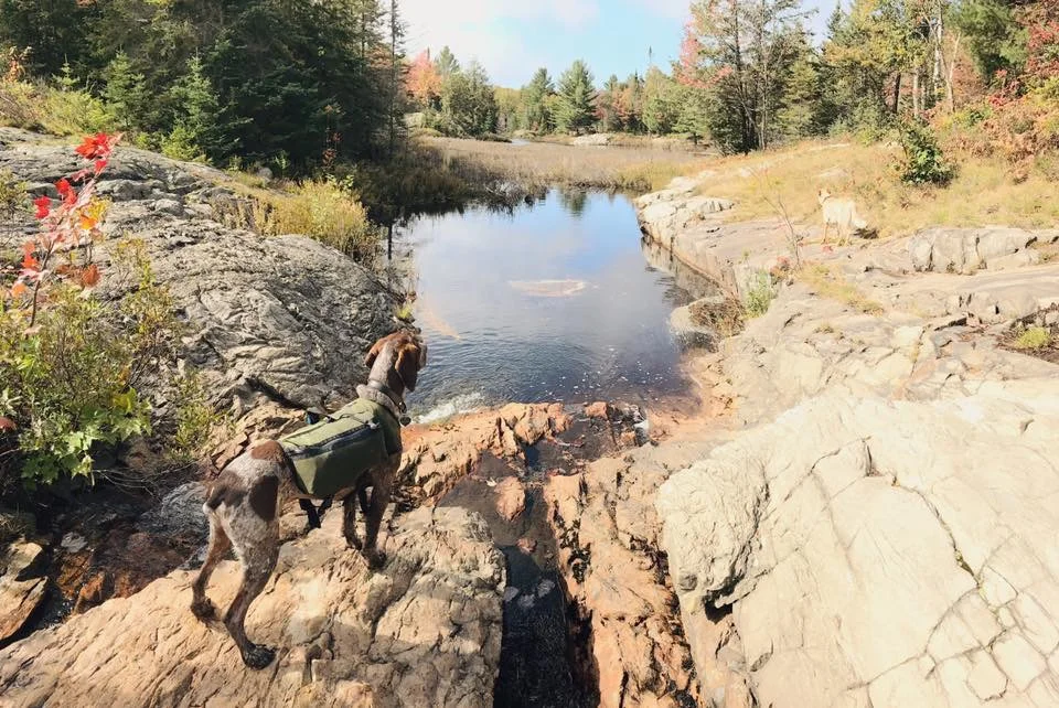
While researching for this trip I kept reading about tricky creek crossings.....I had no such issues as the October water levels are quite low.

The views along the white ridges continued a few hundred more meters and I was pleased to find the marker for my next campsite faster than anticipated. The trail to site H34 on David lake was quite the challenge unto itself! A steep descent down a smooth, slippery rock face followed by a steep climb straight up an exposed rock wall then back down another steep incline to the wooded site on David Lake. The site is very sheltered and I was mildly disappointed to have no direct sun at 2:30, my wet gear dried quickly regardless on an existing clothes line and a nice breeze. It was a treat to have very easy water access and I took the extra time to clean myself up a little and finally take care of my feet. The next day would be a gruelling 21k stretch across the entire Hansen Township section of the trail. I pre packed my bag and prepped all the dog food for the am, hanging everything but my tent and sleeping bag up the food rope, to help ensure a swift departure in the AM.

David Lake

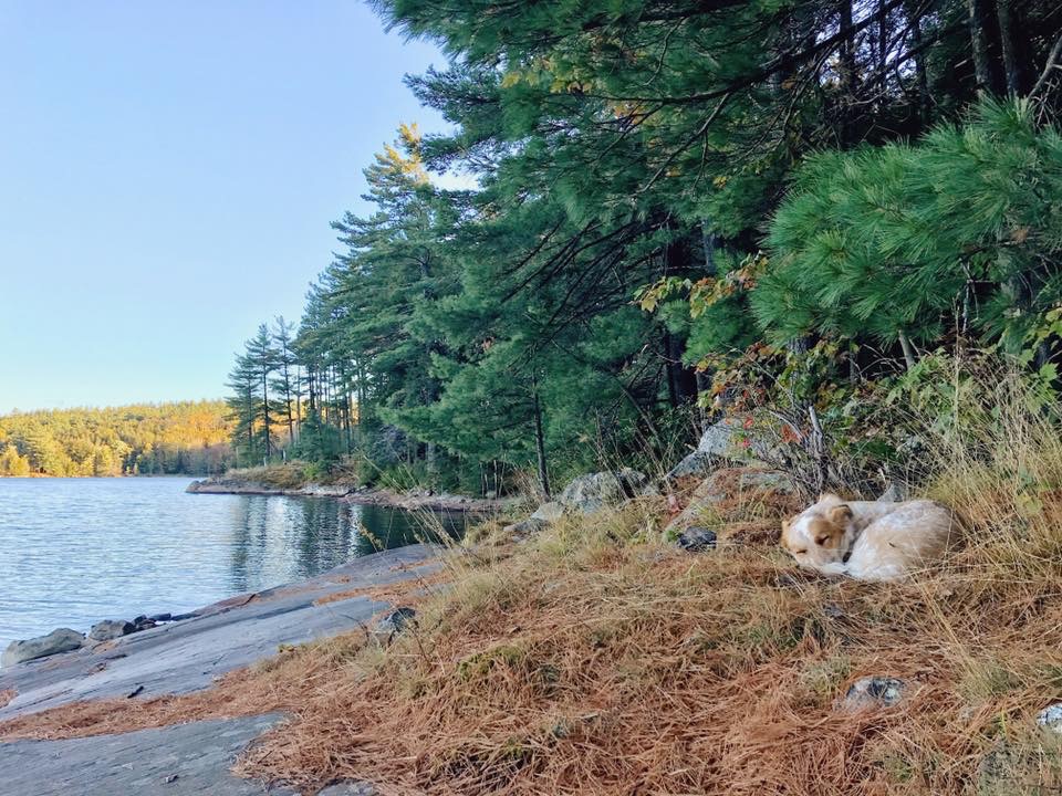
Naptime.

Campsite H34
DAY 4: DAVID LAKE- THREE NARROWS (H20) 21.5k-169 Floors climbed
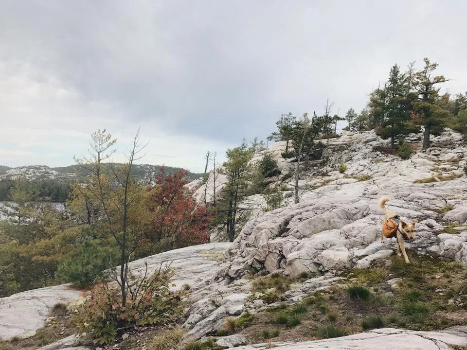
I had been worried about this day ever since I took a real’ good look at my map and noticed all the serious climbs and descents that were along this 21k section. With my pre packed bag and already prepped breakfast (overnight coconut-chia pudding with freeze dried strawberries) and dog food. I was out of camp by 8:15 which is an hour later than I had planned....even with all my prep work tearing down camp still takes way longer when you’re alone. The initial climb up the campsite side trail was just as steep as I remembered but it meant I was starting the day on top of a ridge, a quick start to the day as I could cover ground quickly on elevated but fairly level ground. I trust the dogs more on these open areas as my line of sight is better and there are fewer squirrels to chase. This section of the trail was extroidinarly scenic. The dogs and I popped in and out of several types of forests while climbing the steepest sections of the trail I had encountered so far. Twice along the way the dogs required assistance up tricky sections. The handles on their packs made for easy lift ups!


This was the first of two tricky climbs, 250 meters of steep smooth rock with not much to grab onto. ....I couldn’t imagine doing this in the rain....

Little Mountain Lake snack and water break.
The climb out of the Little Mountain lake area was very strenuous/intimidating. Its roughly 250 meters straight up a steep exposed quartzite slope. I was once again very happy to be travelling counter clockwise as coming down this section would have been very scarey! I took a few minutes at the top to enjoy the scenery and eat a few snacks to keep my energy up. The next few hours seemed to fly by as we zipped through forests that had the largest trees of the entire trail and felt extra magical. Passing several lookouts onto three narrows lake I was enjoying the opportunity to view some of the canoe-in campsites I had previously stayed at from a new and exciting vantage point.

Big trees!

Threenarrows lake meant we were more than halfway to our next checkpoint! I think Wendy felt my energy shift and decided to celebrate with a good roll!

We stayed at a campsite on threenarrows last year....you can see it in the bottom left corner of the lake in this photo....very cool to see the park from so many vantage points.
The next few hours took us through moose pass, down the face of a waterfall and one more VERY tricky section straight up a rocky wall. This particular obstical was the scariest section for me. With close to 20km already hiked that day and the dogs requiring assistance on precarious ground I was extra cautious while lifting them up the rocks, making sure to keep my footing while holding onto the sturdiest roots and rocks I could find. The dogs were so good, waiting patiently while I lifted one and then the other up and over some sections that required literal climbing as opposed to hiking. The remainder of the day was extreamly easy, a slow descent off the ridge into the forest surrounding Threenarrows. We crossed a couple more creeks (again much easier than anticipated due to the low water levels). When I finally rounded the corner and saw the marker to H20 I cried just a tiny bit! I was so happy to have finished this day with no complications AND before nightfall. H20 wasn’t as beautiful as the previous 3 sites I had camped on. There were rogue tent poles, a large abandoned paperback novel and some trash around the fire pit. I did what I could to tidy up before rushing to make camp before the sunset. A quick dinner and a scramble to find a suitable place to hang the food bag and I was very happy to crawl into my tent with the dogs for the night.
DAY 5- THREENARROWS-TOPAZ LAKE 16.6k
I took my time getting going in the morning. I had a fair bit of ground to cover but the terrain was extreamly flat and all forest walking to the next campsite so it would be much easier going than the last section. I was really looking forward to making it into the site at Topaz lake. I booked an extra night’s stay at this site. I had heared it was gorgeous and would be meeting Andrew and my friend Shannon there the following day. The prospect of human company and cold beer was a huge motivator through this last solo leg of the trip.

H20 in the morning.

This is where I realized I had mis-read the map and had an extra 4kms to hike!

The mutts crossing a HUGE beaver damn.

Almost the entire day weaved through different types of wooded areas. It was really cool to see the types of trees and vegetation change from one section to the next. The final leg of the day walked down a beautiful creek with a steel bridge to cross about 2kms along the trail. I stoped for a minute to check out these waterfalls and briefly considered walking across.....the low water levels looked promising and I considered the tantalizing possibility of a shortcut. I ended up taking the long way around as I couldn’t confirm there was an actual way across beyond my line of sight by looking closely at the map. Better safe than sorry! The last time I was on “the Pig” portage was last year while on a canoe trip with Andrew and the dogs. I was happy to be on familiar ground but the steep climb along the loose boulder trail to Topaz lake seemed extra long this time! The acess to Topaz Lake was halfway down the peak of this portage. The side trail itself is no joke either....a steep climb up is quickly rewarded with the stunning view of Topaz Lake. I took my time setting up camp. The entire trip had felt so gruelling and rushed and the idea of spending 2 nights on this spectacular sight while taking in the scenery brought on an immense feeling of relief and accomplishment. That night I had time and energy to start a fire, I was lucky enough to hear wolves howl that night....it was the first time I was up late enough the whole trip!

Topaz Lake
Day 6- REST!! TOPAZ LAKE
It rained heavily overnight and the inside of my tent and sleeping mat got soaked due to a poor choice in tent location and improper footprint installation. It was daylight by the time I noticed the problem so I got up and set up a tarp so my things would have a chance at drying before bed again. I spent the morning exploring Topaz Lake. It was moody and very foggy, there are incredible views of the surrounding area on the south side of the lake which made for a dramatic view while enjoying my morning coffee.

Morning Fog.
The dogs heared company arrive way before I did....I was so happy to see Andrew and Shannon that I didn’t even think about how stinky I was! Cold beer, proper fire cooked food and extra cuddles for the mutts were the perfect reward for all the hard work we had put in over the past few days.

Andrew and Rufio
DAY 7-TOPAZ LAKE-LUMSDEN LAKE 7km
It was a short hike to the next and final site of the trip. Lumsden Lake (H1) is the closest site to the George Lake access point. The campsite was perfect. Plenty of room for the now two tents, spectacular scenery and plenty of super flat, sunny rocks to lounge on while the sunset. The perfect last night along the trail.

Lumsden Lake

Sunset Wendy

Rufio

Some pumpkin spice...
The following morning was a short 2k walk back to the car and into clean clothes! I couldn’t believe it had been a whole week already. There were several groups just starting their hikes in the parking lot and I was almost jealous that they were just beginning ! The challenges and difficulty of this trail are perfectly rewarded with the splendid scenery and moments of elation as you travel across the stark peaks and ridges of the La Cloche mountains. I’ve seen so much of Killarney over the past year or so and I look forward to visiting again...it is truly the jewel of Ontario’s parks.

The foggy walk out in the a.m.